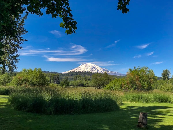
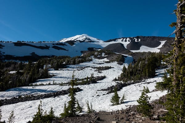
The view of Mt. Adams from the Elk Meadows RV park.
Located in the southern portion of central Washington, Mt. Adams is the 2nd highest volcano in the state. Our initial goal had been to summit Mt. Rainier, but we weren’t able to align everyone’s schedule with the nearly nonexistent, acceptable weather windows. As we saw our opportunities for Rainier shrink, our friend Katie suggested we join her and her dad Fred on a climb of Mt. Adams. The South Climb (or Lunch Counter Approach) is a less technical route (i.e. no glaciers to cross), and Mt. Adams tends to have better weather than Rainier. But with a summit of 12,276 feet it would still be a good test of our conditioning, and ability to handle climbing at altitude.
On top of being very pleasant to spend time with, it turns out Fred has a lifetime of mountaineering experience. His knowledge, wisdom and advice before, during and after the climb was invaluable. I can’t really overstate how much Julie and I appreciated having Fred on our first climbing adventure! Oh, and Katie was fun too!!
Contrary to the consistently excellent long range forecast, as we checked in with the rangers, we were disappointed to learn that a storm system would be moving across the area that afternoon. Although, with only a 20% chance of showers, and more protected camp sites at lower elevations, we decided to head up the mountain as planned.
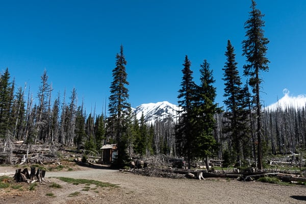
The typical two day Mt. Adams climb includes a 14 mile drive to the trailhead from Trout Lake, WA, the last 3 miles being a one lane, pot-holed mess. The trailhead starts at about 5,500 feet, and climbers usually set up camp at a flat-ish area called Lunch Counter, around 9,000 feet. Given the forecast (rain and high winds), we planned to set camp lower down the mountain. And for the most part, everything went according to plan.
I’ll let the pictures tell the rest of the story:
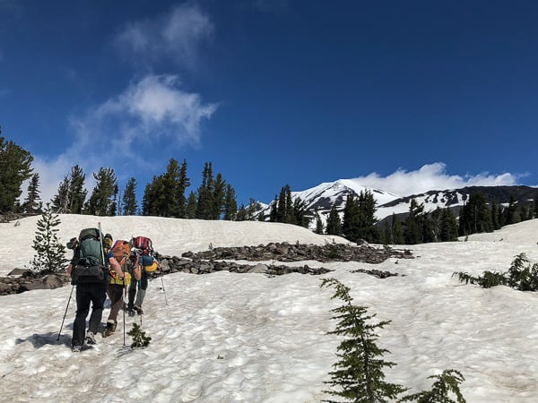
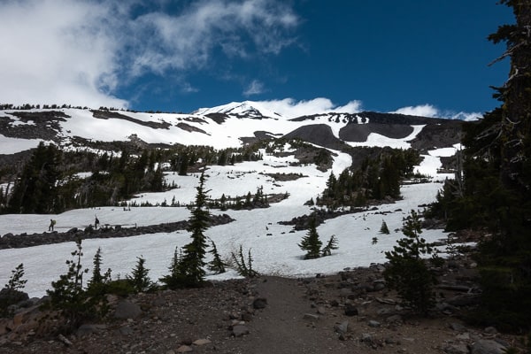
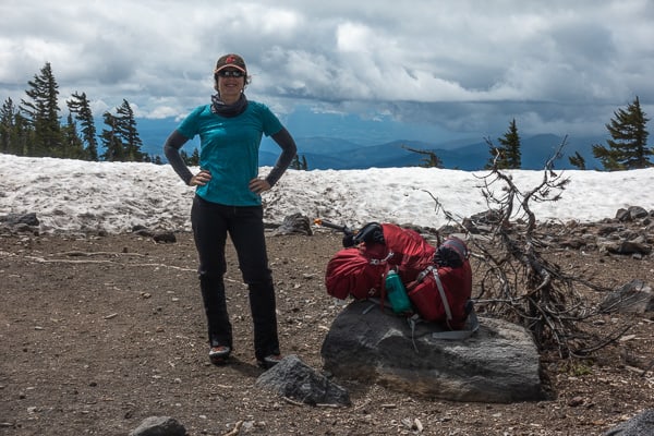
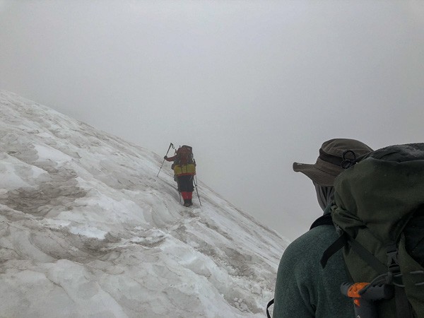
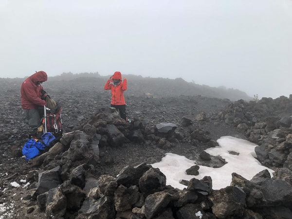
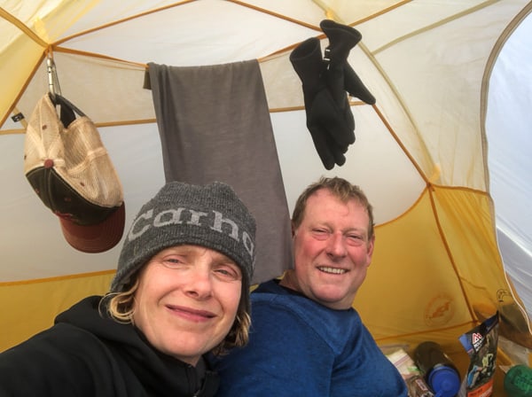
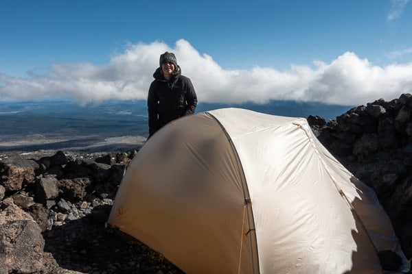
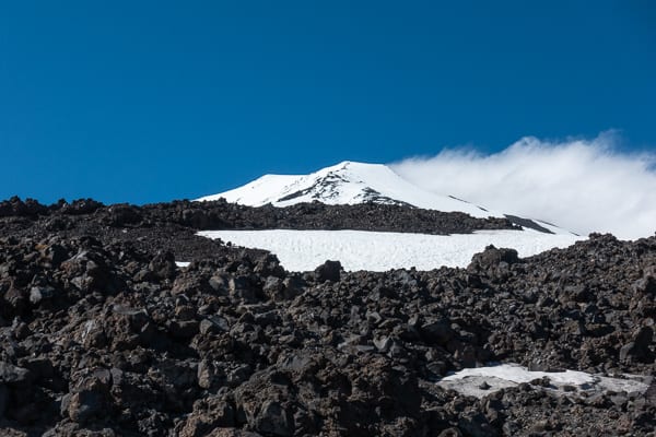
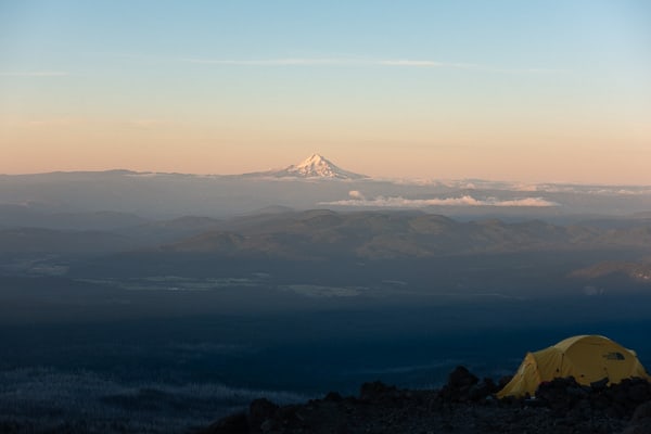
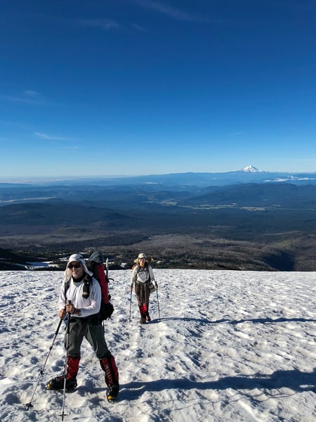
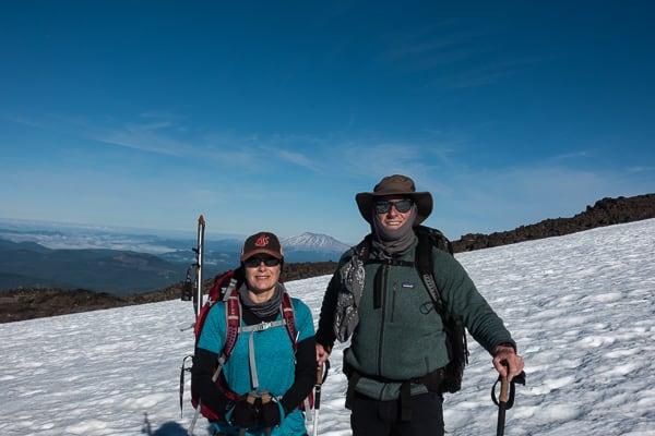
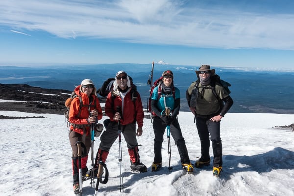
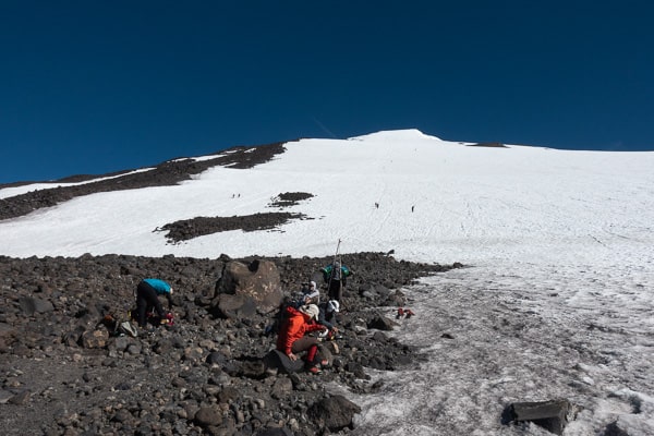
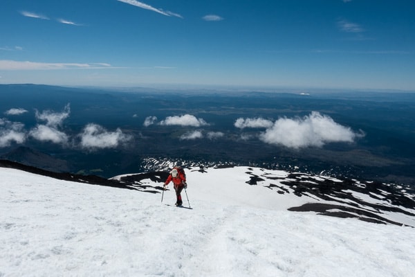
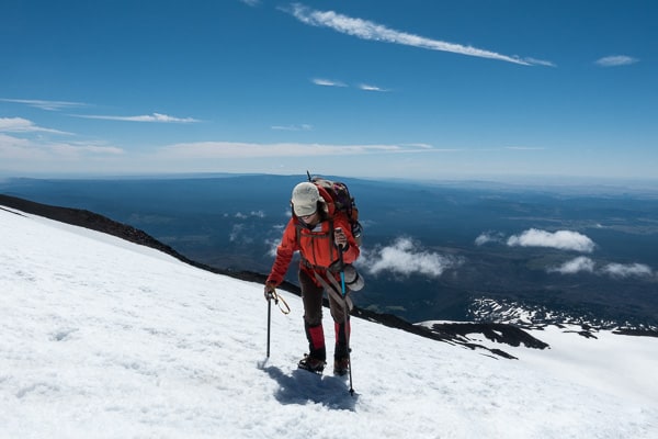
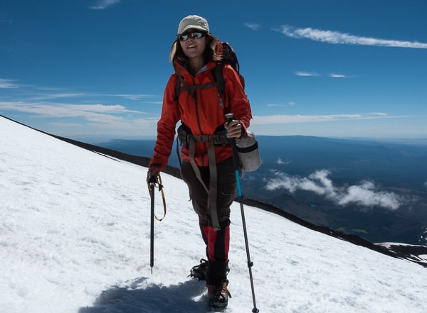
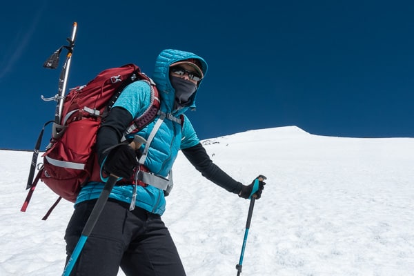
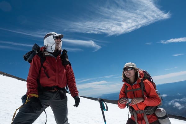
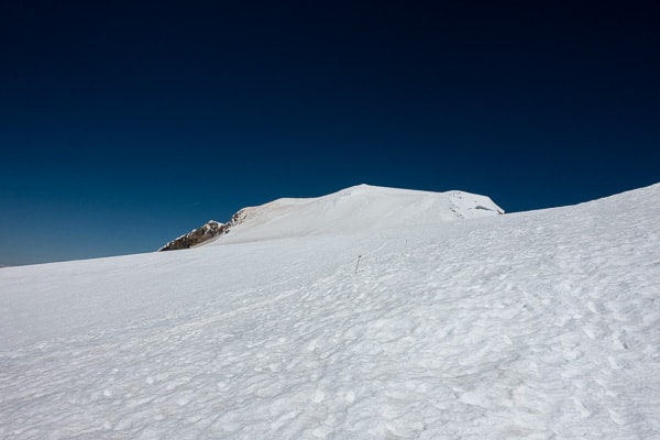
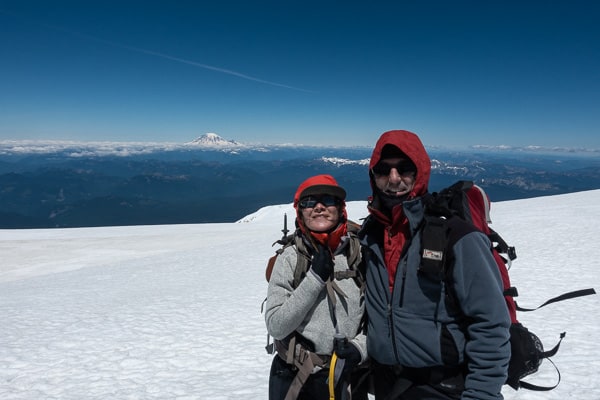
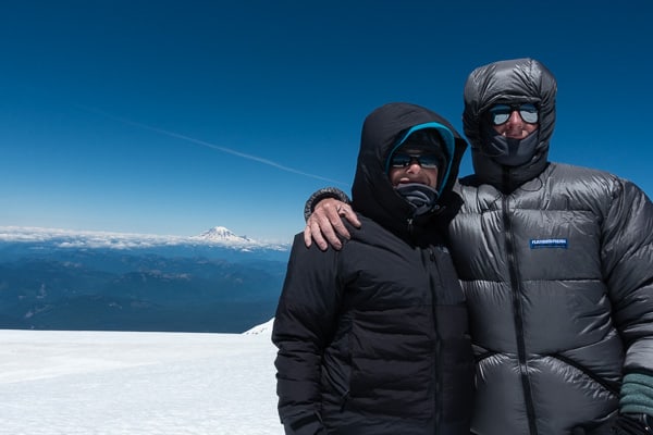
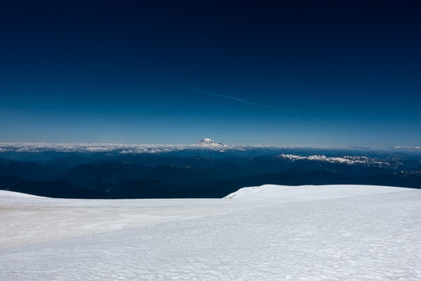
We started our ascent from the trailhead at the Cold Springs camp area (~5,500′).Fred, Katie and Tor make there way through the patchy snowfields near the lower end of the trail.At this point the bare trail came to an end, so we stashed our comfy shoes and switched to our mountain boots for the remainder of the climb.Jules is ready for the snowfields!Yikes! Where’d the sun go!?!Setting up camp in the wind and rain was fun…especially for mine and Julie’s first time!All snug in our tent, we waited out the weather.Fortunately, we didn’t have to wait for long. The sun broke through, and we had gorgeous weather for the remainder of the trip.The view of Pikers Peak (11,300′) from our campsite (~8,000′).The wind died down in the night, and we awoke to a beautiful view of Mt Hood.We set out around 7:30am. Fred and Katie making their way up the snowfield, with Mt. Hood in the distance.Tor and Jules pose with Mt. Saint Helens.A fellow hiker was kind enough to take a group shot (Mt. Hood in the distance).We made last minute adjustments to our boots before the big approach to Pikers Peak. Notice the many glissading trails coming down the mountain. We enjoyed sliding down them on our descent.Katie getting close to Pikers Peak.Almost there!Made it!Julie on top of Pikers PeakFred and Katie take a well deserved rest on Pikers Peak.Your reward at the top of Pikers Peak, is seeing how much farther you still need to go. It’s really just cruel!We made it!! Fred and Katie at the summit of Mt. Adams (12,276′).Tor and Jules bundled up at the summit. You can’t see it in the photo, but it was very windy!View of Mt. Rainier from the Summit. Hopefully we’ll be taking a picture of Mt. Adams from there next year!The afternoon view of Mt. Adams from our shoe stash…only 3 miles left to the truck!